Cape Town Maps and Orientation
(Cape Town, Western Cape Province, South Africa)
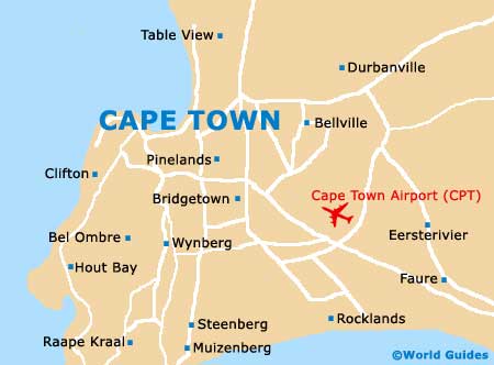
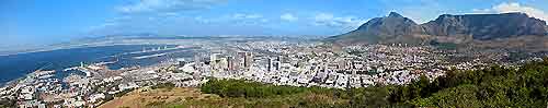
Capital of the Western Cape and one of the most important of all the cities in South Africa, Cape Town is home to the National Parliament, a major harbour, and around 3.5 million residents. The actual city centre resides on the northern side of the Cape Peninsula, with Table Mountain dominating many of the views from all around central Cape Town.
The commercial centre of Cape Town lies directly to the east of Signal Hill and goes by the name of the City Bowl. Close by are a number of very prominent city suburbs, such as those of Gardens, Oranjezicht and also Tamboerskloof.
Maps and Orientation of the City
A very sprawling city, Cape Town covers a long distance to the north-east and this part of the city is where you will find the gigantic Canal Walk shopping centre, along with the beachfront of Bloubergstrand. The southern side of Cape Town borders the easterly mountains and heads towards False Bay, with the neighbourhoods here including Constantia, Newlands and Observatory.
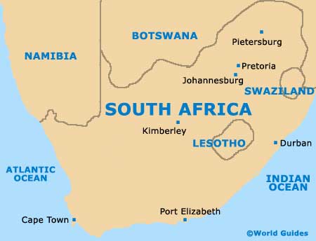
Maps of the city are available at the highly efficient Cape Town Tourism office in the City Bowl, and also close by at the waterfront Cape Metropolitan Tourism centre. Cape Town is well placed to explore the following South African towns and cities:
- Bredasdorp - south-east
- Calledon - south-east
- Ceres - north-east
- Hermanus - east
- Knysna - east
- Langebaan - east
- Malmesbury - north
- Mosselbaai - east
- Paarl - east
- Port Elizabeth - south-east
- Riversdale - east
- Robertson - east
- Somerset West - south-east
- Stellenbosch - east
- Strand - south-east
- Touws River - north-east
- Wellington - north-east
- Worcester - east
Continent Map of Africa

Map of South Africa
Map of Cape Town